Weather
วัดพระธาตุช่อแฮ พระอารามหลวง 1 Moo11 Road ช่อแฮ Sub district Cho Hae District Mueang Phrae Province Phrae 54000
Open
Business hours
• Sunday
: 08:00 - 18:00
• Monday
: 08:00 - 18:00
• Tuesday
: 08:00 - 18:00
• Wednesday
: 08:00 - 18:00
• Thursday
: 08:00 - 18:00
• Friday
: 08:00 - 18:00
• Saturday
: 08:00 - 18:00
Note
: -
Map
Review Score
0
History
แพร่ หรือ เวียงโกศัย เป็นเมืองเล็กๆ ในเขตภาคเหนือตอนบน ตามตำนานกล่าวว่าเมืองแพร่ มีมาตั้งแต่สมัยพุทธกาล ตำนานกล่าวไว้ว่าประมาณ พ.ศ.1371 พ่อขุนหลวงพล พระราชนัดดาแห่งกษัตริย์น่านเจ้าได้อพยพคนไทย (ไทยลื้อ ไทยเขิน) ส่วนหนึ่งจากเมืองเชียงแสน ไชยบุรี และเวียงพางคำ ลงมาสร้างเมืองบนที่ราบริมฝั่งแม่น้ำยม ขนานนามว่าเมืองพลนคร (เมืองแพร่ปัจจุบัน) ส่วนชื่อเวียงโกศัย น่าจะมาจากชื่อดอยที่เป็นที่ตั้งขององค์พระธาตุช่อแฮซึ่งเป็นพระธาตุศักดิ์สิทธิ์ คู่บ้านคู่เมืองแพร่ เนื่องจากสมัยพุทธกาลพระพุทธเจ้าได้เสด็จมา ณ ดอยโกสิยะ แห่งนี้และได้มอบพระเกศาให้กับขุนลั่วะอ้ายก้อมจึงได้นำมาใส่ในท้องสิงห์ทองคำบรรจุไว้ในองค์พระเจดีย์พระธาตุช่อแฮแห่งนี้เพื่อไว้เป็นที่เคารพสักการะ โดยดอยโกสิยธชัคคบรรพต หมายถึง ดอยแห่งผ้าแพร เมืองแพลเป็นชื่อที่ปรากฎในศิลาจารึกพ่อขุนรามคำแหงมหาราช หลักที่ 1 ด้านที่ 4 โดยคำว่าแพลน่าจะมาจากศรัทธาของชาวเมืองที่มีต่อพระธาตุช่อแพร หรือช่อแฮที่สร้างขึ้นภายหลังการสร้างเมืองต่อมาจึงได้เรียกชื่อเมืองของตนว่า เมืองแพล และได้กลายเสียงเป็นเมืองแพร่ปัจจุบัน
วัดพระธาตุช่อแฮ พระอารามหลวง เป็นที่ประดิษฐานพระธาตุช่อแฮซึ่งเป็นหนึ่งในพระธาตุประจำปีเกิดของผู้ที่เกิดปีขาล (ปีเสือ) องค์พระธาตุมีลักษณะเป็นเจดีย์ทรงแปดเหลี่ยม ย่อมุมไม้สิบสองบุด้วยทองดอกบวบ สูง 33 เมตร ฐานสี่เหลี่ยมกว้างด้านละ 11 เมตร ศิลปะแบบเชียงแสน วัดพระธาตุช่อแฮตั้งเด่นสง่างามอยู่บนเนินสูงสามารถมองเห็นได้จากถนนในระยะไกลมีบันไดนาคเดินทางขึ้นไป
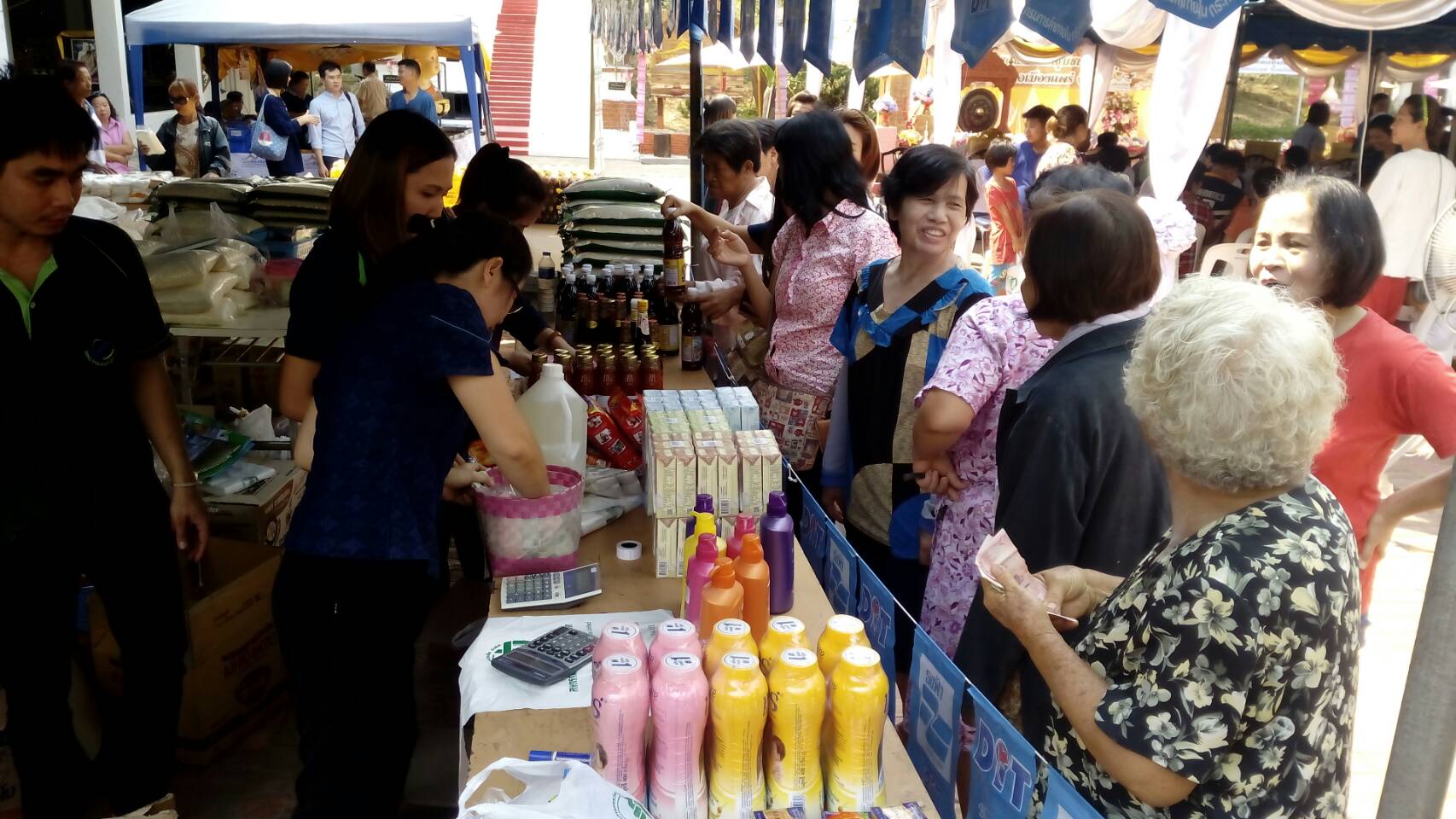
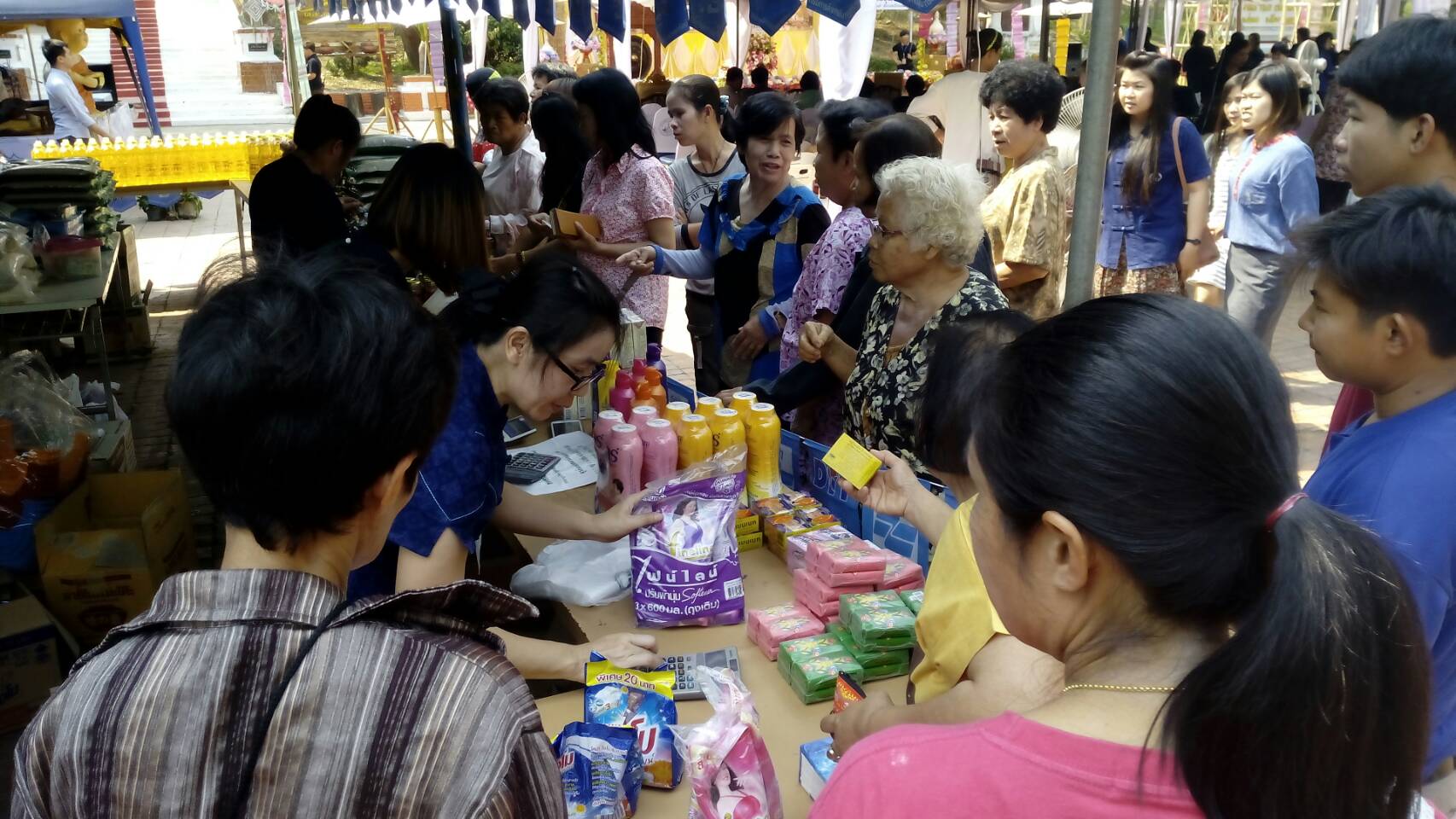
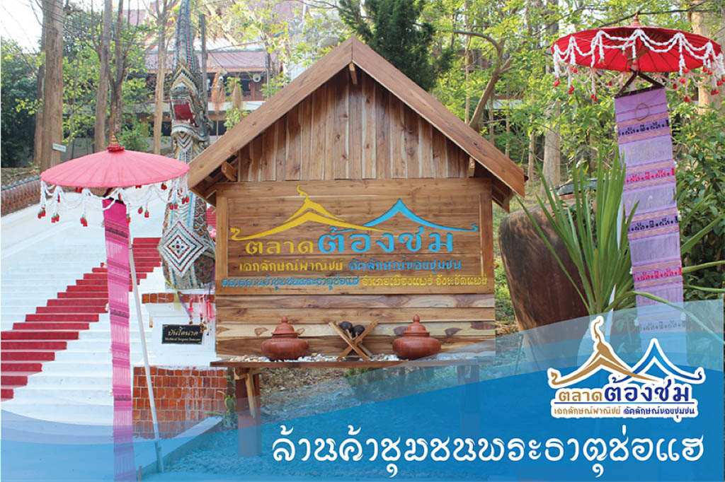
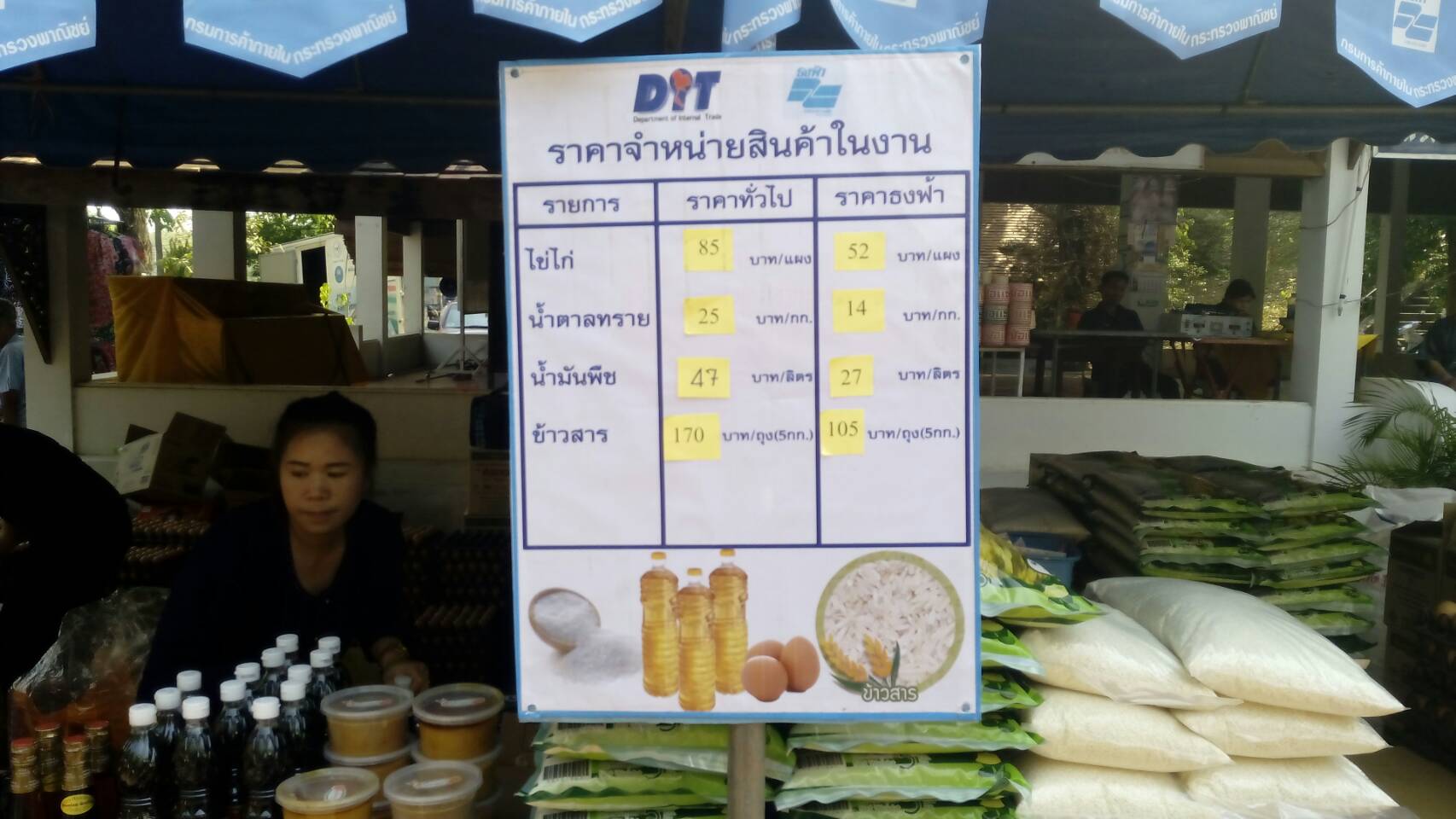
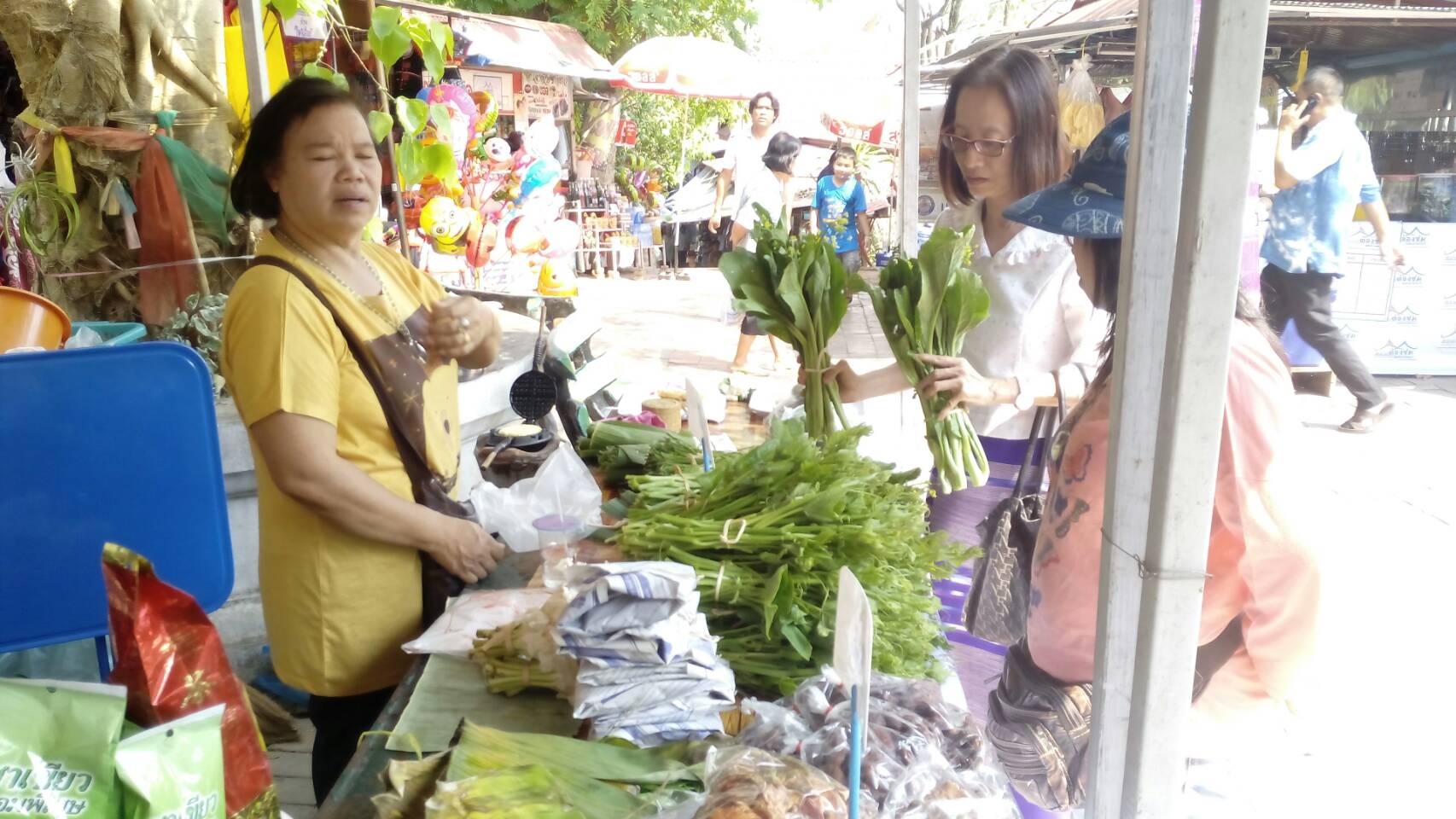
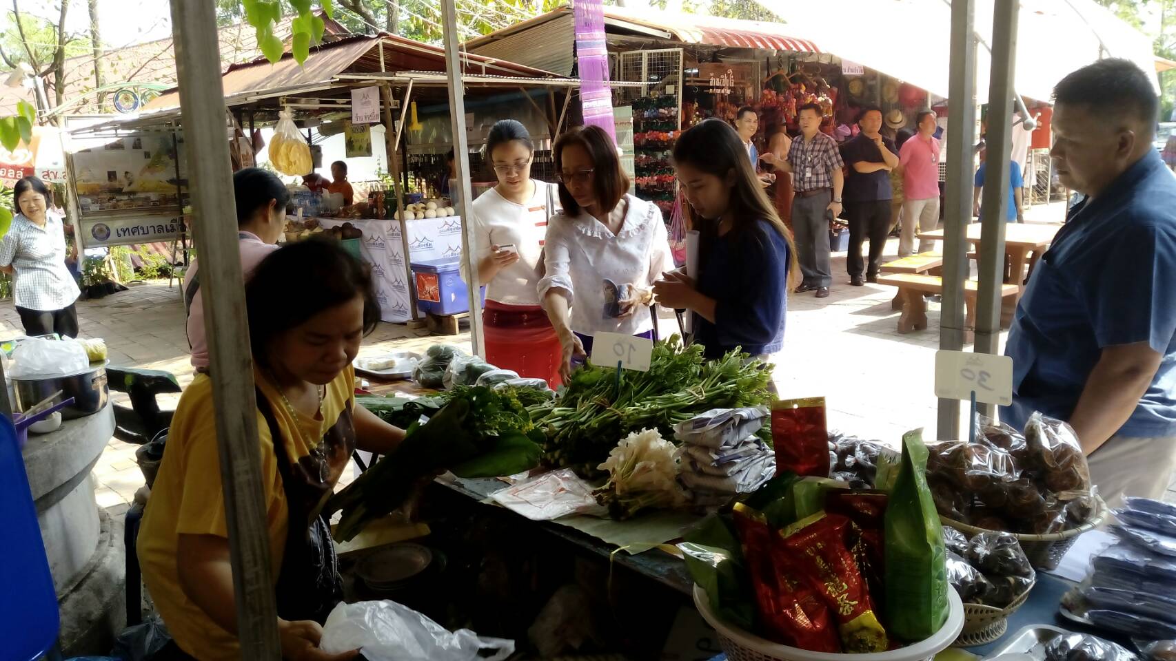
กระทรวงพาณิชย์ โดยกรมการค้าภายใน ร่วมกับวัดพระธาตุช่อแฮ และเทศบาลตำบลช่อแฮ ขอเชิญนักท่องเที่ยวที่เดินทางมานมัสการพระธาตุช่อแฮมาจับจ่ายใช้สอยที่ ตลาดต้องชม ตลาดลานค้าชุมชนพระธาตุช่อแฮ ทุกวันตั้งแต่เวลา 08.00-18.00 น. ตลาดแห่งนี้เป็นตลาดที่เกิดจากการส่งเสริมของหน่วยงานภาครัฐส่วนกลางและส่วนท้องถิ่นที่ทำงานบูรณาการร่วมกันเปิดตลาดต้องชมขึ้น จึงถือเป็นโอกาสดีที่จะสร้างเอกลักษณ์พาณิชย์ อัตลักษณ์ของชาวแพร่ ส่งเสริมให้เป็นแหล่งช่องทางการกระจายสินค้าหัตถกรรม ของที่ระลึกจากไม้แกะสลัก ผ้าทอ เสื้อผ้าหม้อห้อม และสินค้าเกษตรกรรมเช่น ผักสด พืชสมุนไพรในท้องถิ่น กว่า 90 แผงค้า
วัดพระธาตุช่อแฮ พระอารามหลวง เป็นที่ประดิษฐานพระธาตุช่อแฮซึ่งเป็นหนึ่งในพระธาตุประจำปีเกิดของผู้ที่เกิดปีขาล (ปีเสือ) องค์พระธาตุมีลักษณะเป็นเจดีย์ทรงแปดเหลี่ยม ย่อมุมไม้สิบสองบุด้วยทองดอกบวบ สูง 33 เมตร ฐานสี่เหลี่ยมกว้างด้านละ 11 เมตร ศิลปะแบบเชียงแสน วัดพระธาตุช่อแฮตั้งเด่นสง่างามอยู่บนเนินสูงสามารถมองเห็นได้จากถนนในระยะไกลมีบันไดนาคเดินทางขึ้นไป
กระทรวงพาณิชย์ โดยกรมการค้าภายใน ร่วมกับวัดพระธาตุช่อแฮ และเทศบาลตำบลช่อแฮ ขอเชิญนักท่องเที่ยวที่เดินทางมานมัสการพระธาตุช่อแฮมาจับจ่ายใช้สอยที่ ตลาดต้องชม ตลาดลานค้าชุมชนพระธาตุช่อแฮ ทุกวันตั้งแต่เวลา 08.00-18.00 น. ตลาดแห่งนี้เป็นตลาดที่เกิดจากการส่งเสริมของหน่วยงานภาครัฐส่วนกลางและส่วนท้องถิ่นที่ทำงานบูรณาการร่วมกันเปิดตลาดต้องชมขึ้น จึงถือเป็นโอกาสดีที่จะสร้างเอกลักษณ์พาณิชย์ อัตลักษณ์ของชาวแพร่ ส่งเสริมให้เป็นแหล่งช่องทางการกระจายสินค้าหัตถกรรม ของที่ระลึกจากไม้แกะสลัก ผ้าทอ เสื้อผ้าหม้อห้อม และสินค้าเกษตรกรรมเช่น ผักสด พืชสมุนไพรในท้องถิ่น กว่า 90 แผงค้า
Source
กรมการค้าภายใน
Recommended
Entrance fees
• Entrance fees: Fee
- Foreigner (Adult)
:
- Foreigner (Child)
:
- Thai (Adult)
:
- Thai (Child)
:
• Remark : -
Review (0)
Write Review
0
จาก 5.0
Availability
Value
Service
Relate Agritourism

- Watch the fish and mussels raising in cages,
- Cultivation of seagrass
- Study mangrove ecosystem
- Processing of salted fish with nets/sea food
- Toei Panan Weaving
tourism program
- Arrive at the group office. Listen to a briefing on the history of Ban Pru Jude Cage Fish Farming Community Enterprise
- Learn how to raise aquatic animals in cages
- Take a boat trip to see the mangrove ecosystem. Study mangrove forests, hot springs, visit Boonkong Bay, plant seagrass to conserve food for dugongs in the Trang sea, visit various islands, beaches, return to the accommodation, have dinner, see the community's way of life in the morning. Seafood Processing Group, Kang Mung Salted Fish, Toei Panan Basketry Group, buy souvenirs, Travelling back
Route links with other attractions (with distance/km)
- Pak Meng Beach 8 km.
- Hua Hin Beach 3 km.
- Rajamangala Beach 6 km.
Note: The distance measurement is taken from the point of the group office as a starting point
Community enterprise products in the community
Agricultural products, seafood, salted fish with nets Toei Panan wicker products
Trang

Phra That Yasothon or Phra That Anon located in front of the ubosot; it is one of the important old relics in the northeastern region. It has Rectangular chedi with a top similar to Phra That Phanom, and inside the Phra That contains the relics of Phra Anon. The construction was influenced by Laos art that was popularly built during the late Ayutthaya period to the early Rattanakosin period which corresponds to the history of setting up the city and the history of Wat Mahathat
Yasothon
Natural color is used to dye the Mudmee. It is the OTOP product selling at Bann Na Kha, Bangkok, and bann Chiang. The group weaves the textile from the customer’s order so it generate income to people in Bann Daeng District.
Udon Thani
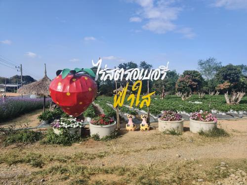
There is a photogenic Violet in front of the farm and it is available to pick fresh strawberries from the trees here.
Nakhon Ratchasima
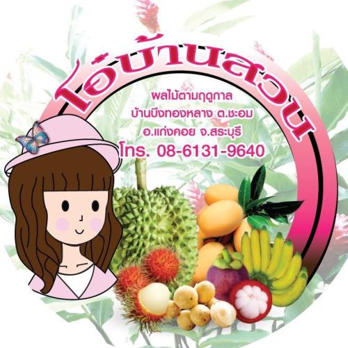
Seasonal fruit garden with fragrant durian, sweet rambutan and delicious mangosteen; affordable price, pay attention to every plant delivered directly to the customer
Saraburi
1. Form of activity: see and study the production process of jasmine rice, volcanic soil, weave mat demonstrate, fabric dyeing from soil at Ba Rai holy well. Sightseeing plant herb production area and herbal processing, buy some souvenir or product and agricultural goods, OTOP center. You can try yummy food in KhanToke style and see Apsara Dance, see view by bicycle, take a rest at homestay, visit rural market in the morning.
2. The way of community: cultivation, southern east livelihood, traces of Khmer civilization.
3. The Participation of tourist: tour, taste, shopping, snap, share, do and learn agricultural station.
Tourism Program
2 days 1 night
Frst day, Check in at the accommodation, rent some bicycle, see how to produce volcanic jasmine rice station, see how to plant vegetable and herbal processing, having lunch at Baray reservoir. Afterwards, visiting at Mueang Tum Ruin, see around the community by bicycle in the evening then make some traditional dinner at homestay (KhanToke style and see Apsara dance but it is depend on coustomer's demand because it is an extra charge), lie down at homestay.
Day 2 Visit morning rural market, give food to the monks, have a meal at homestay, weave mat demonstrate and fabric dyeing from soil at Ba Rai holy well, weave fabric as Paco Fern pattern (Pak Krood) and buy some silk fabric with Pak Krood pattern at The OTOP center, go up the hill to visit Khao Phanom Rung National Park
The route that linking with the others tourist attraction
1. Mueang Tum Ruin distance 500 meters.
2. PhanomRung Historical Park distance 5 kilometers.
3. Phu Akkanee Dye Fabric group distance 23 kilometers.
4. Wat Khao Ang-Karn Chaloem Phra Kiat district distance 25 kilometers
Buri Ram
Phu Kaset is a high mountain with a wide stone terrace, and turn into Tad Hang Waterfall in the rainy season
There are many different shapes of rocks that arose naturally, and it has a steep cliff; it is the location of Wat Phu Kaset (Dan Hin Hua Nak).
Amnat Charoen
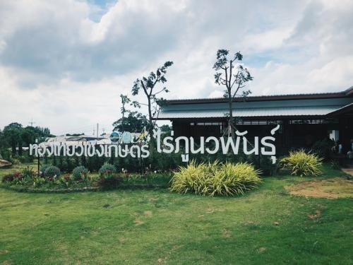
Phu Nawaphan Vineyard It is a vineyard with processed products of grapes, grapes, grape juice, etc.
Saraburi
1 agricultural learning ground of Ban Na Nam Sam, 10 grounds as follow:
1) Learning ground for the production of bio-based substances (Trichoderma, Beauveria, BT, wild microorganisms, nematodes)
2) Charcoal/Wood Vinegar Distillation Learning Ground
3) Local egg raising ground
4) Mushroom cultivation ground
5) Organic Asparagus Planting ground
6) Freshwater fish farming ground
7) The composting ground
8) Herbal Refinery Ground
2 Study natural attractions
1) Pha Nam Thip Cave Sacred water from nature
2) Bat Cave, discover the natural wonders of millions of bats.
3) Chompoo Cave
4) Wat Khao Sam Yot
5) Tad Fa Waterfall
6) Tad Tao water
7) Phu Ta Lor Cave
8) Dong Sakran Viewpoint
9) Dong Lan Forest Development Project
3 agricultural learning resources
1) Growing Asparagus
2) Planting and propagating guava
3) Longan orchard generates income
4) Mushroom cultivation for additional income
tourism program
2 days 1 night program
Learn about agriculture at 1-2 ground center > have lunch > visit Pha Nam Thip Cave > watch bats > have dinner > relax at homestay / Phu Pha Man Camp > Asparagus plot > Golden banana plantation > Khao Temple Sam Yot > have lunch > go back
Note – Tour programs and service fees may change as appropriate.
- 3 snacks
1 day program
Learn about agriculture at center 1-2 bases > have lunch > visit Pha Nam Thip Cave > watch bats > go back
Note – Tour programs and service fees may change as appropriate.
- 2 snacks
Route links with other attractions (with distance/km)
1) Pha Nam Thip Cave Sacred water source from nature, a distance of 3 km.
2) Bat Cave, a distance of 6 km.
3) Chompoo Cave, a distance of 4 km.
4) Wat Khao Sam Yot, a distance of 6 km.
5) Tad Fa Waterfall, a distance of 18 km.
6) Nam Phut Tat Tao, a distance of 12 km.
7) Phu Ta Lor Cave, a distance of 16 km.
8) Dong Sakran Viewpoint, a distance of 18 km.
9) Dong Lan Forest Development Project, a distance of 22 km.
Community enterprise products in the community
1 Ban Son Tai Community Shop, Village No. 3, Ban Son Tai, Non Kom Subdistrict, selling Phu Pha Man folk clothes
2 Ban Non Kom Community Shops, Village No. 1, Ban Non Kom, Non Kom Subdistrict, selling local products and souvenirs.
Khon Kaen
Community Enterprise, Fruits Quality Promotion Group Phato Sub-district, Phato District, Chumporn Province operates agrotourism by networking with the tourism groups in Phato District. Activities available here are rafting, garden touring, fruit tasting, trekking, and visiting a waterfall. Besides, traditional food tasting, such as orange curry with banana stalk and pork belly, stir-fried Liang leaves with egg, rice in bamboo, and traditional coffee tasting.
Chumphon
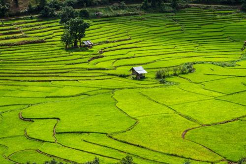
Rice terraces, Pid Thong Lang Phra Project is located in Chaloem Phrakiat District. It is a project under the royal initiative. Nan province is a pilot province to carry on the royal initiatives of His Majesty the King. Her Majesty Her Majesty the Queen The project's approach is to start with reducing the use of forest areas. Seeking new methods of growing rice by adopting terraced farming methods on mountain areas instead of paddy rice in order to solve poverty problems sustainably By focusing on the villagers to think for themselves But the government will go in to educate and find a suitable model for solving the problem of coexistence between people and forests in Thailand. upstream forest area Projects here are not only digging terraced rice fields, but also constructing water storage ponds, weirs, and soybean planting. including animal husbandry
Nan